COVID-19 Policy Map
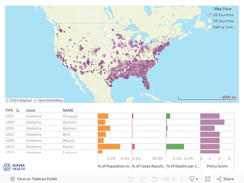
Below is a visual for the largest county-level COVID-19 policy dataset in the nation, which is completely open-source and covers 1,320 U.S. counties and 100+ Native American nations. The U.S. Department of Health and Human Services has endorsed and posted the dataset on the federal COVID-19 data reporting hub. Because this granular county-level data is more representative, it has already uncovered trends not seen in state-level analyses as it’s currently being used by policymakers, epidemiologists, economists and other researchers across the nation.
Size of each circle: total number of COVID-19 cases within the county to date.
Color of each circle: percentage of county population that have had COVID-19 to date.
Policy Score: how many of the 7 main COVID-19 policy interventions are in place within the county to date.